Your browser doesn't support the features required by impress.js, so you are presented with a simplified version of this presentation.

For the best experience please use the latest Chrome, Safari or Firefox browser.

Big Data: Using ArcGIS with Apache Hadoop
David Kaiser    @ddkaiser
Michael Park


Esri DevSummit 2013

Session Offering ID: 301
Follow along with this presentation
Use WiFi network: Esri2013
GIS Tools for Hadoop
Hadoop users often have data with spatial value, but
with limited options for spatially analyzing this data

Esri has released an open-source framework to enable
spatial-data processing in your Hadoop applications

This enables you, as a developer, to build analytical tools
that use both Hadoop and ArcGIS.
Why is this important?
Your Hadoop applications can
provide spatial analysis
  ...and your users can leverage your Hadoop applications
from within the ArcGIS Geoprocessing environment
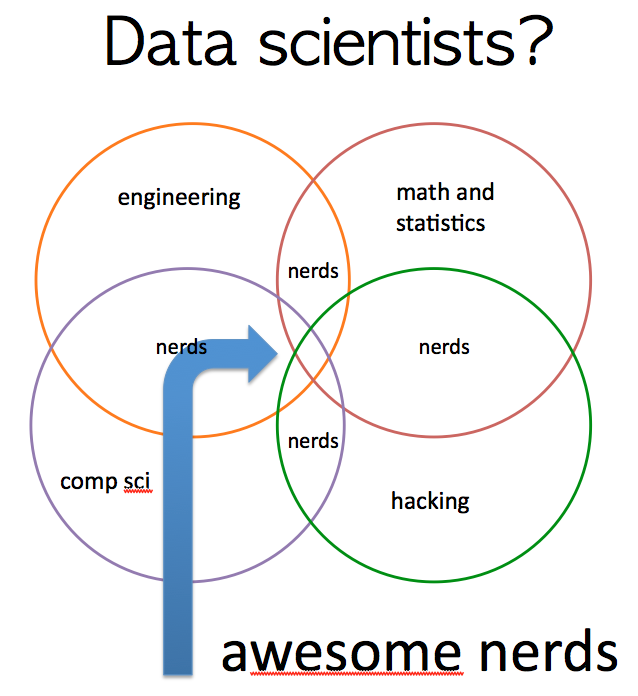
Who is a Data Scientist?
Finding Your Data Scientist
www.hilarymason.com
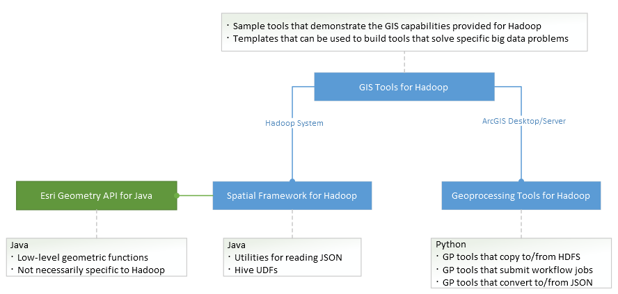
GIS Tools for Hadoop
The Hadoop 'Tools' are a combination of
custom Hadoop applications and ArcGIS GP Tools.
Geometry API for Java
Simple API Functions for Java

com.esri.core.geometry.*
Relationship Analysis
  • equals
  • disjoint
  • touches
  • crosses
  • within
  • contains
  • overlaps
Operations
  • buffer
  • cut
  • clip
  • convexHull
  • intersect
  • union
  • difference
Spatial Framework for Hadoop
Enables developers to:
  - spatially enable MapReduce applications

Enables Hadoop users to:
  - run spatial Hive queries with ST_Geometry functions

Provides Java API's for:
  - JSON Utility classes
  - Hive UDF's

Uses the Geometry API for Java
Spatial Data in Hadoop

JSON files store collections of 'features'
  - Unenclosed JSON is the dominant style; simple and appendable
  - Enclosed JSON can optionally be used as a 'feature class'
        (A collection that should be analyzed as a complete set)

Accessing geometries from Hadoop Data Sources
  - com.esri.hadoop.json  -  access JSON data as arrays of 'features'
  - com.esri.core.geometry  -  construct geometry from arguments


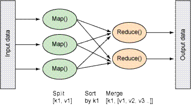
Developing Custom MapReduce Apps
Simple MapReduce Code Sample
void setup() {
    iStream = hdfs.open(new Path(config.get(“input")));
    featureClass = EsriFeatureClass.fromJson(iStream);
}

void Map(Long key, Text value) {
    float longitude = Float.parseFloat(values[COL_LONG]);
    float latitude =  Float.parseFloat(values[COL_LAT]);
    Geometry point = new Point(longitude, latitude);

    for (EsriFeature feature : featureClass.features) {
        if (GeometryEngine.contains(feature.geometry, point) {
            String name = feature.attributes.get(LABEL_ATTR);
            context.write(new Text(name), data);
            found = true;
            break;
        }
    }
}
Demo
ST_Geometry in Hive
SELECT counties.name, count(*) cnt FROM counties

JOIN earthquakes

WHERE ST_Contains (counties.boundaryshape,
ST_Point (earthquakes.longitude, earthquakes.latitude))

GROUP BY counties.name
ORDER BY cnt desc;
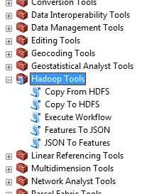
Geoprocessing Tools for Hadoop
Features To JSONJSON To Features
 - Provide serialization to and from JSON formats

Copy To HDFSCopy From HDFS
 - Moves files between ArcGIS and Hadoop

Execute Workflow
 - Starts a workflow using the Hadoop Oozie workflow engine

Demo
Download the GIS Tools Project
Clone or Fork the project from Github
http://github.com/Esri/gis-tools-for-hadoop

Pre-built samples in the 'samples' directory

Place your completed tools in the 'tools'
directory if you want to share them
Get the Source Code
Geometry API
    http://github.com/Esri/geometry-api-java

Spatial Framework for Hadoop
    http://github.com/Esri/spatial-framework-for-hadoop

Geoprocessing Tools for Hadoop
    http://github.com/Esri/geoprocessing-tools-for-hadoop

To build the source:
    ant
Contributing Your Work
Fork the gis-tools-for-hadoop project
- Hack on the code
  -> Make new tools
    -> Do awesome spatial analysis on big data
- Send a Github 'pull request' so we can
   pull the tool back into our project

Let us know how you are doing
- Add your content to the Wikis on Github
- Troubles?  Open new Issues in Github
We want your feedback!
Session Feedback
http://esriurl.com/survey
Session Offering ID: 301
E-mail:
    David Kaiser  <dkaiser@esri.com@ddkaiser
    Michael Park  <mpark@esri.com>

Use a spacebar or arrow keys to navigate